

After 6 days in Nauru, the world’s least visited country, we forced ourselves up early at 3:00am for a 5:15am Nauru Airlines flight to currently the world’s 3rd least visited country: Kiribati (pronounced “Kiri-bahs”).
We wanted to head in pretty early as we didn’t want to risk stranding a group of 21 people for another 4-5 days for the next available flight out.
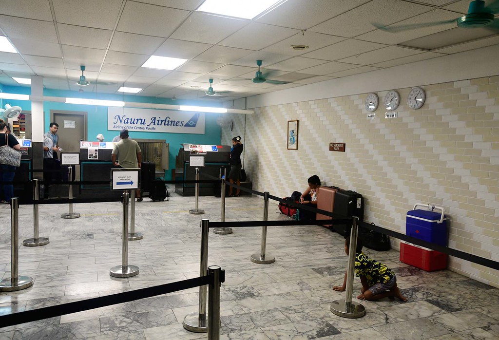
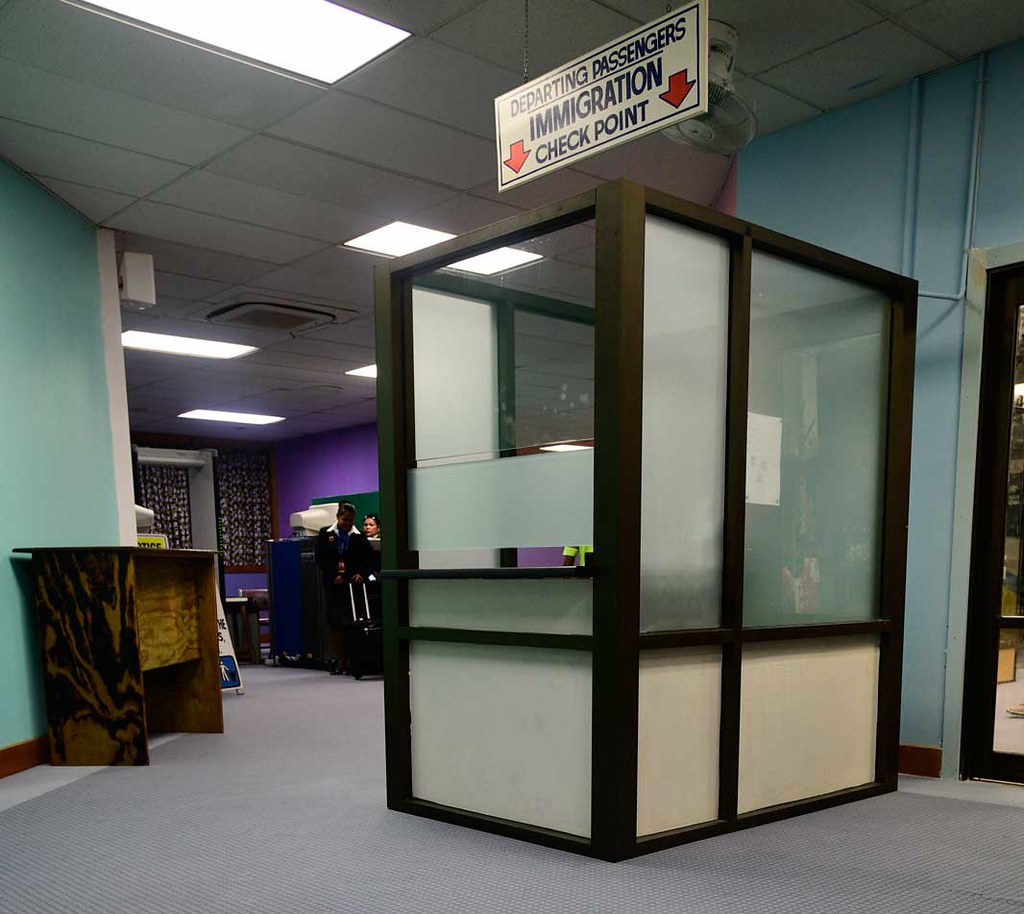
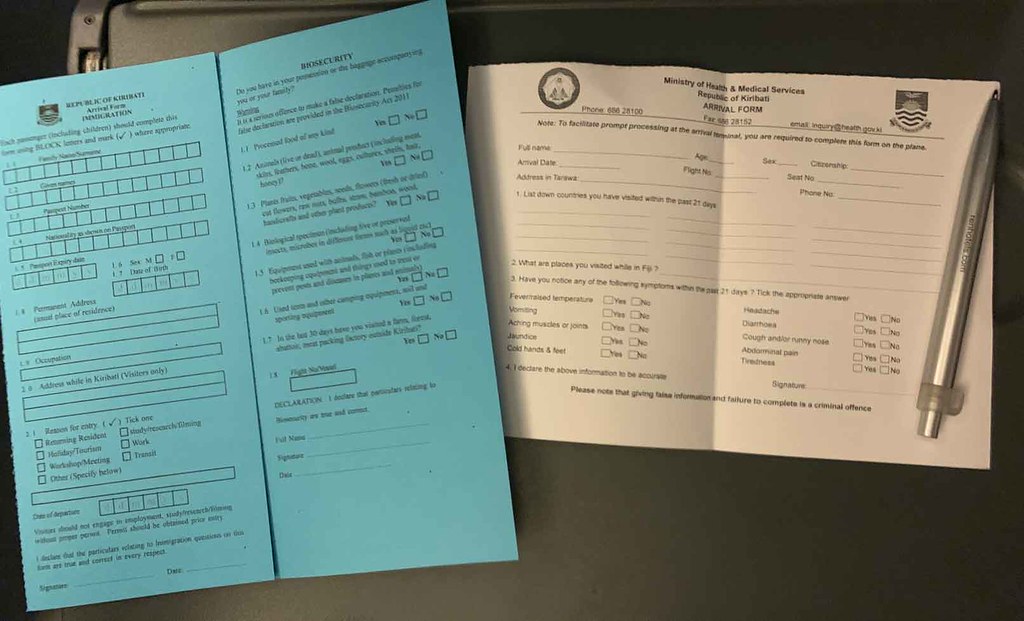
Once arriving at Nauru airport, we checked in and stamped out rather quickly.
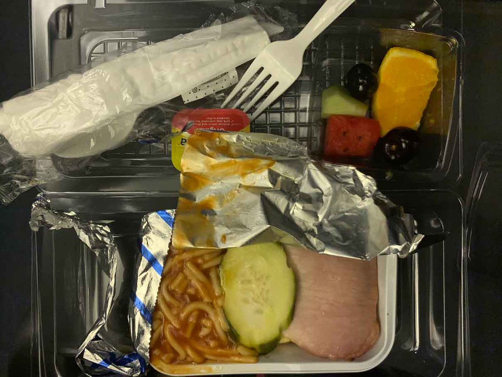
We boarded a little later than scheduled at 5:20am.

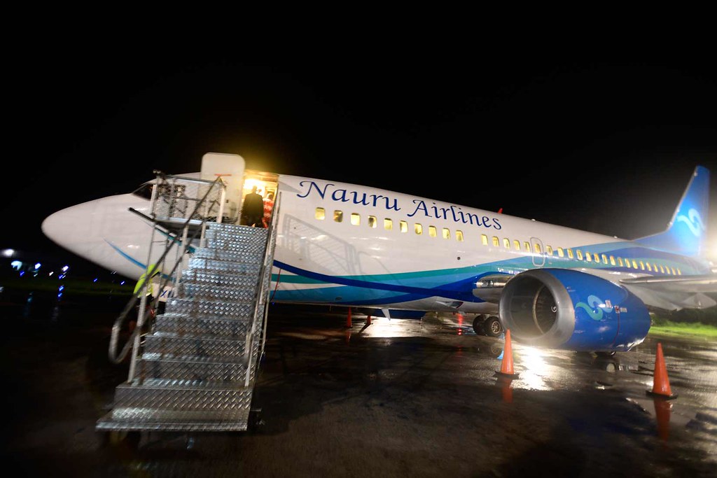
The flight took approximately a little over one hour, and yet we somehow got a hot breakfast and a few drinks included within that time frame. Not even US airlines can offer that much!
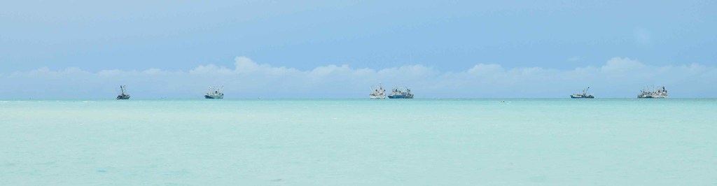
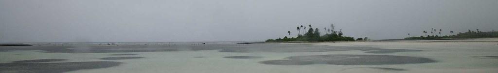
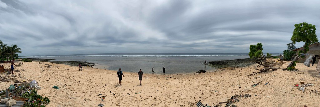
We landed in Bonkiri International Airport at 7am in Tarawa, the capital city of Kiribati. A wall of water greeted us as we disembarked.
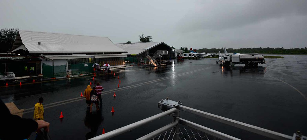
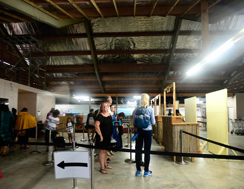
The Bonriki International Airport at the time of posting is also undergoing some hardcore renovations. I was surprised they even would keep it open for us.
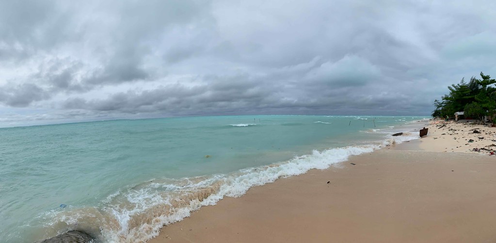
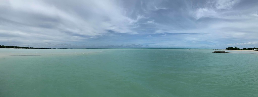
As the rain cleared we saw that the waters in the lagoon here is almost as blue if not bluer than the waters off in the Caribbean. This is the stuff of brochures.
For those geography and history buffs, Kiribati was formerly the Gilbert and Elise Islands before it gained independence in 1979. Kiribati spans 33 islands, atolls and reefs that stretches east to west over Micronesia and Polynesia, with 40% of the landmass belonging to Kiritimati Island, the largest atoll in the world.
Despite its breadth larger than the surface area of India, most of the country is only a few meters both wide and tall, as Kiribati is one of world’s lowest lying nations. Most of the country faces the dire prospect of sinking into oblivion within the next 50 years.
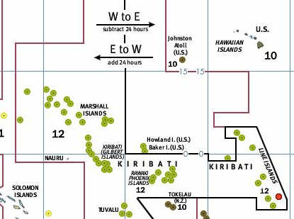
Kiribati is also the only country in the world that cross all 4 hemispheres, as it traverses BOTH the international date line and the equator. This leads to pretty confusing time zone calculations as being in Kiribati means you could be living both in today and tomorrow.
To explain this, the international date line “east” was expanded in 1995 to accommodate Kiribati’s eastern chain of islands to have UTC+13 and UTC+14, which overlaps the UTC-10 and UTC-11 time zones. That means if you’re in Hawaii, only miles directly north of Kiribati, you are still 25 hours (yes more than a WHOLE DAY) behind Kiribati. That also means that everyday for 2 hours you could be in 3 days at once.
This also means Kiribati is the first country to ring in a new year and first to see the sunrise, hence “Land Of The First Dawn.”
If you’re still confused by this, oh well. So are we.
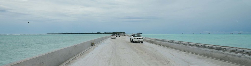
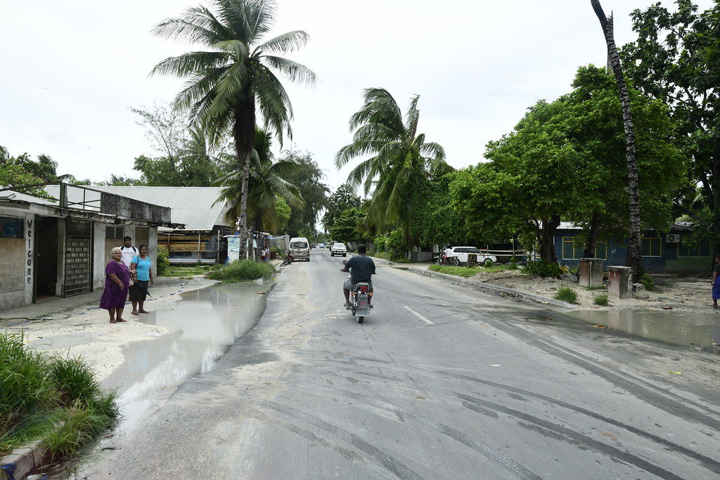
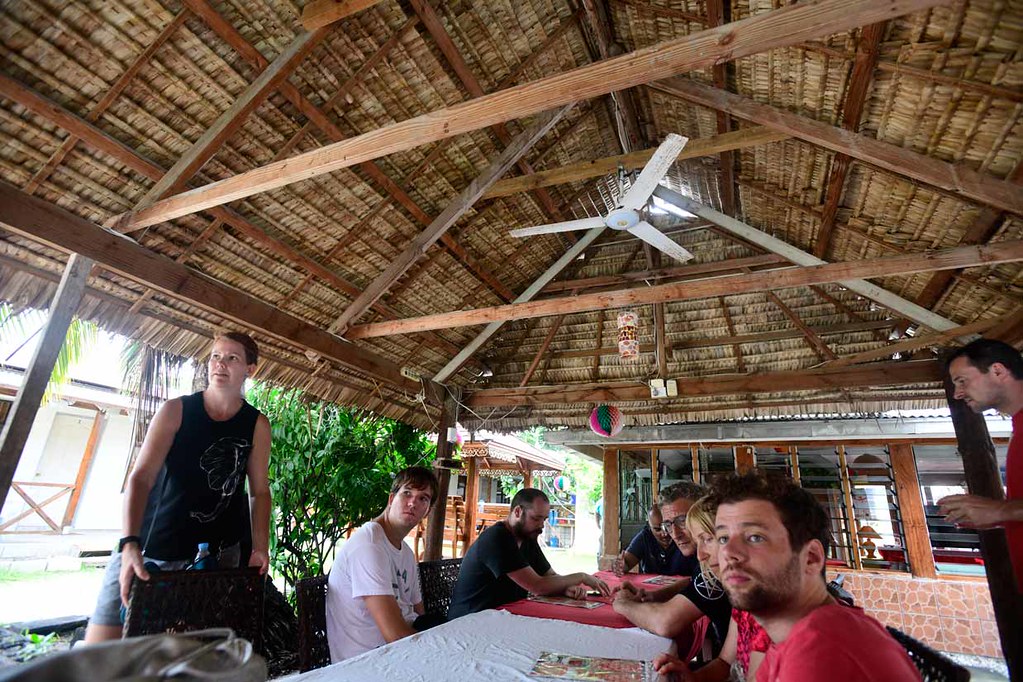
We got a quick pick-up at the airport and took a half hour’s drive to Mary’s Motel in the Bairiki district where we caught up on sleep for a few hours.
At around 11:30am we re-congregated watching parts of an old documentary film on the battles that took place here during World War II before crossing the bridge west to Betio to explore the island’s actual World War II past, as this was where one of the bloodiest battles occurred.
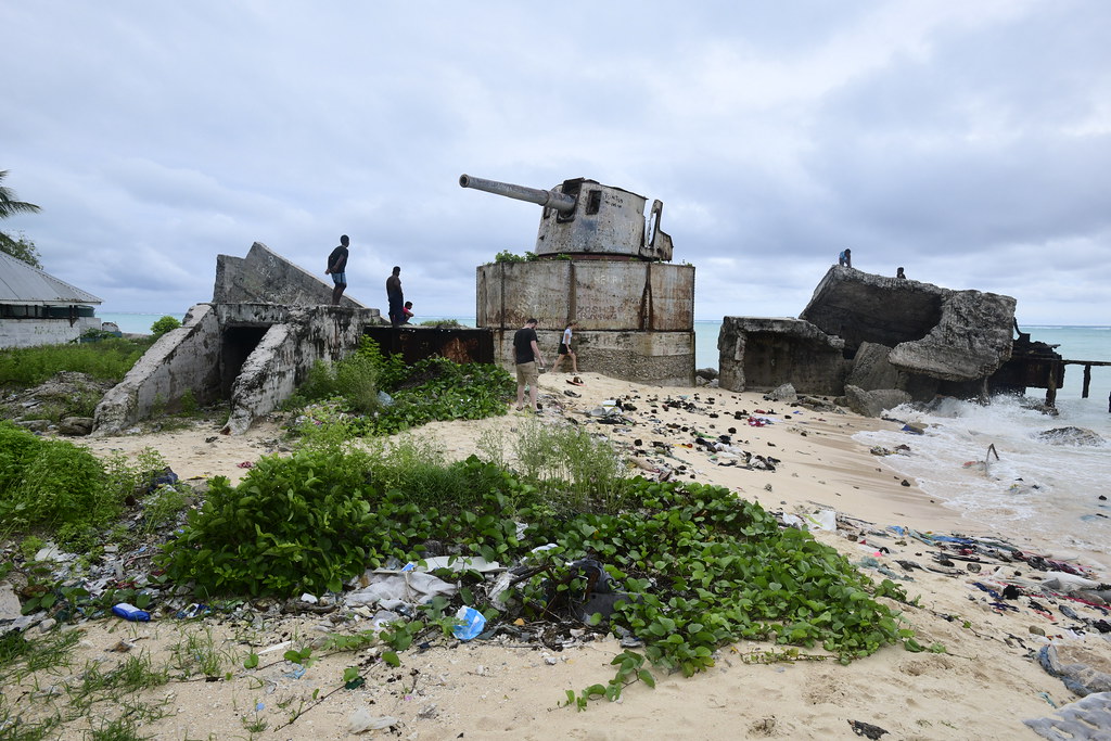
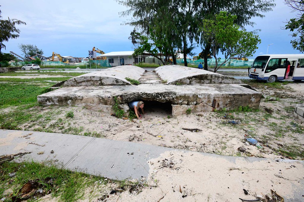
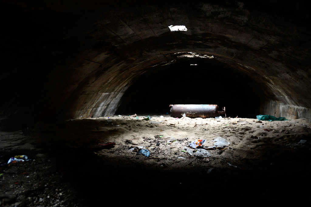
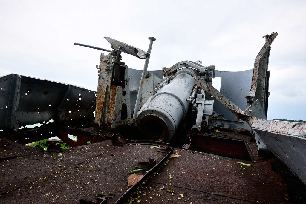
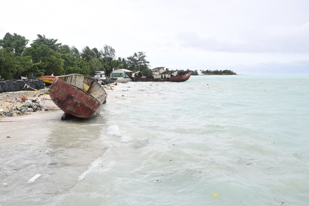
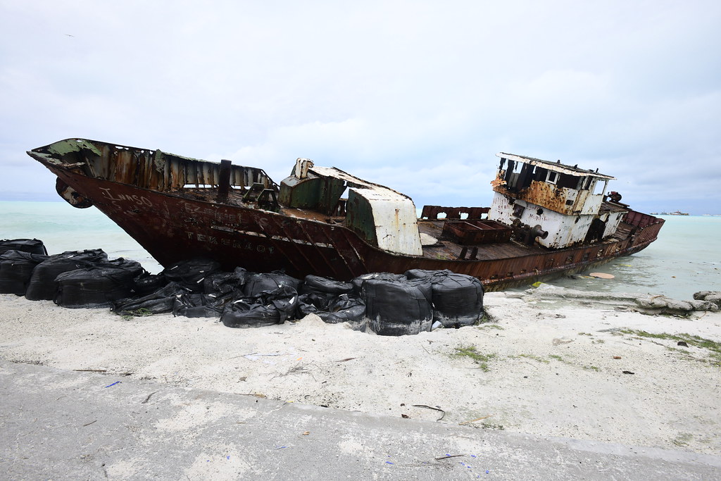
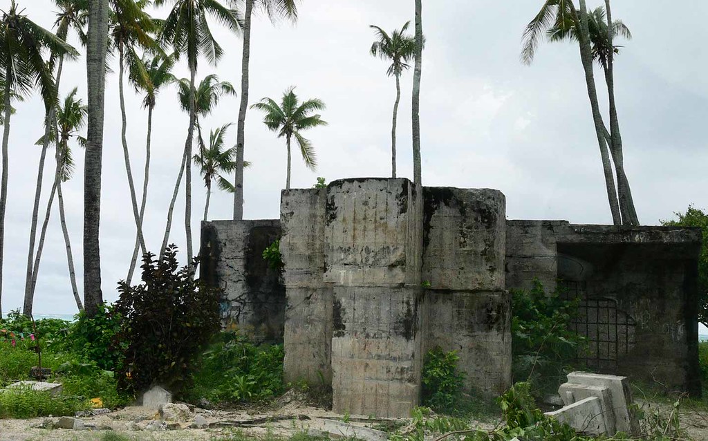
We stopped on a few beachheads and got to spelunk a number of abandoned war relics, such as coastal defense guns, bunkers and pillboxes, tanks, and shipwrecks.


Care to crawl into an abandoned ammunitions depot? Well here in Betio Island, you can!
Want to climb aboard a sea cannon? You can do that too!
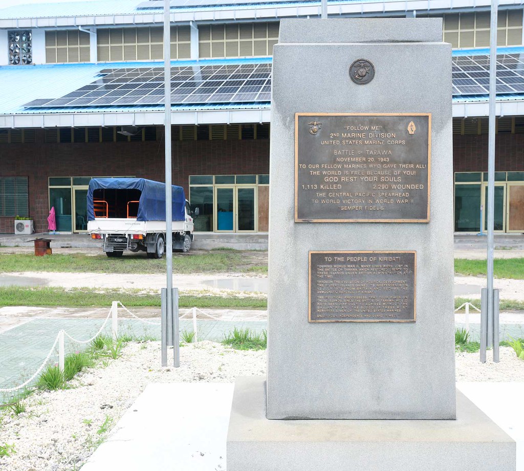
The highlight was a stop at the Red Beach, where a majority of the US Marines and defending Japanese soldiers died. You can find the New Zealand Memorial to U.S. Marines and Navy erected here.
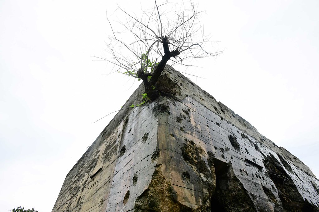
We also stopped by the former Japanese Command Center, which now has been overrun by nature.
The Japanese War Hospital largely has remained intact as it was built in a shape of a cross to prevent wanton bombing.
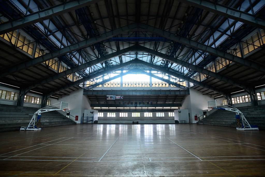
There’s also a simple US WW2 memorial by a gymnasium:
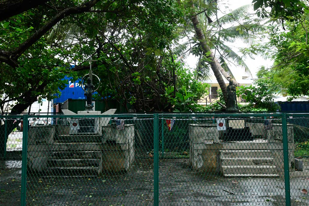
… as well as a Japanese WW2 memorial a few steps away, which has been locked away behind a series of fences by a local Japanese man to prevent vandalism.
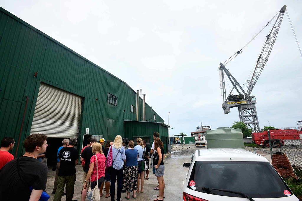
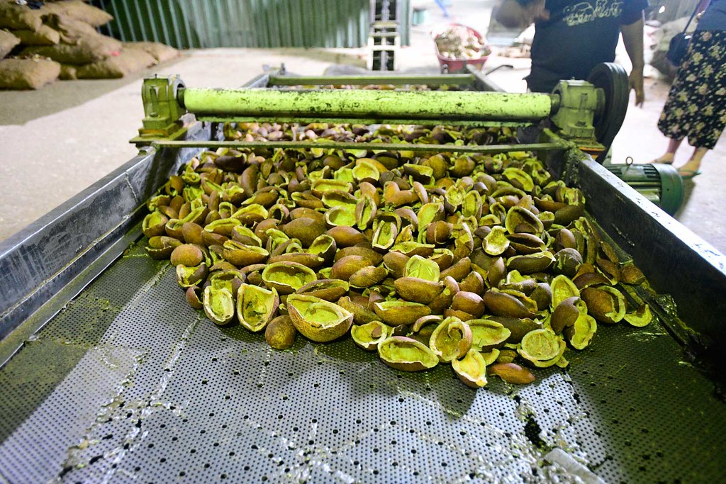
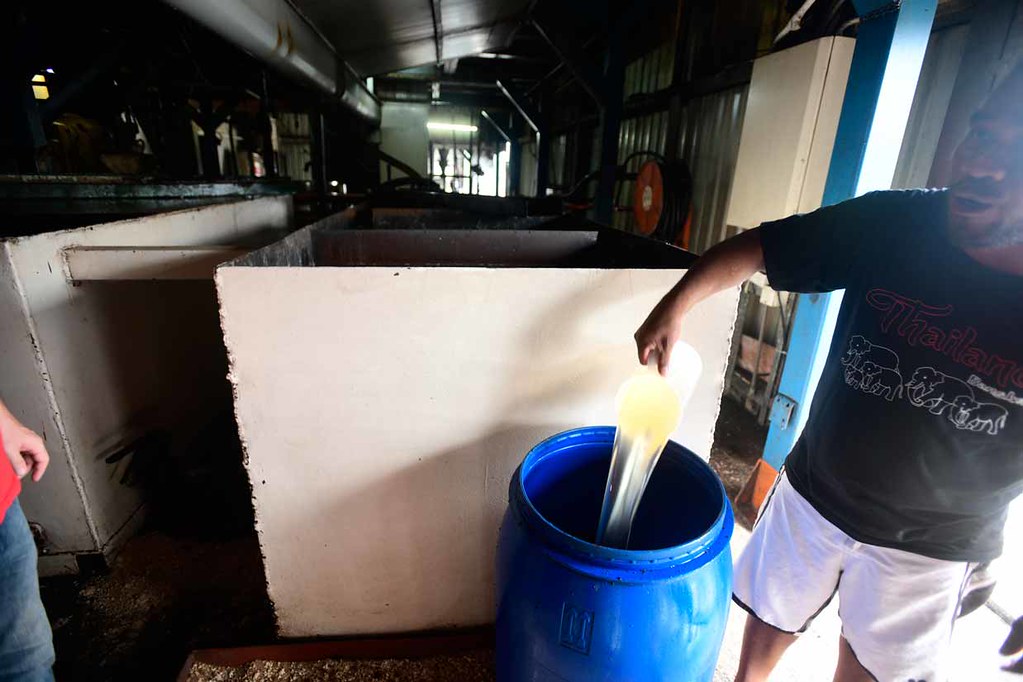
Afterwards we stopped in to peek inside a massive coconut oil plant.
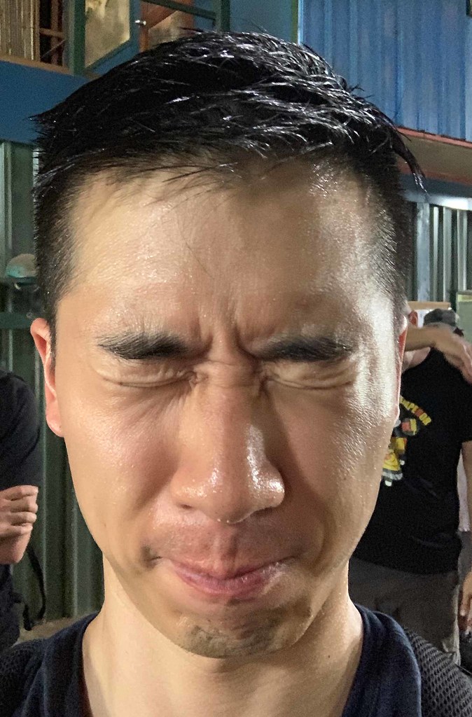
There I happily drenched myself (and my hair) in pure virgin coconut oil.
Afterwards we had dunch and drinks at the Hotel George, where they serve some amazingly fatty sashimi. We just had to cross a decent-sized lake to get there.

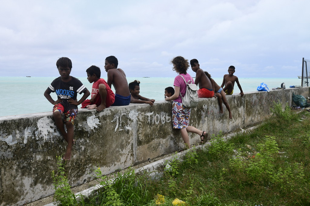
The next morning after a late breakfast, we headed in the opposite direction from yesterday to explore the northern part of Tarawa, beginning with another scenic beach. Legend has it that the decent-sized craters on the beach rocks are said to have been made by “giants” long ago.
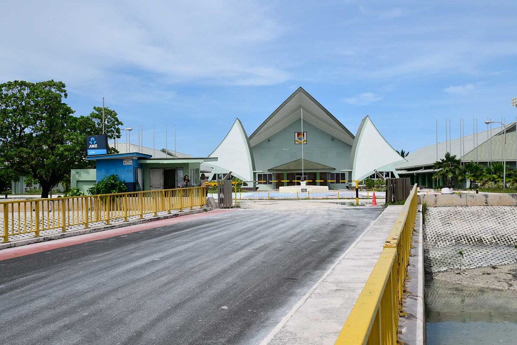
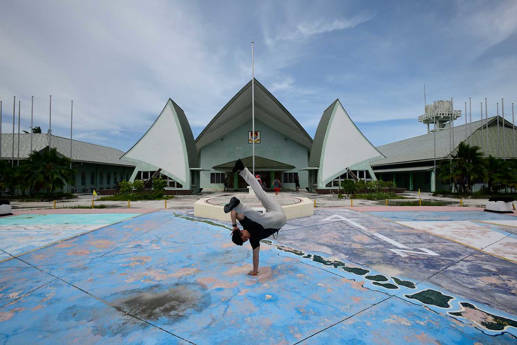
After a few minutes here we drove towards the photogenic Parliament building, which only opens 4 times a year for all the leaders of the respective islands of Kiribati to congregate.
We then visited a local Taiwanese fishery (where I met a budding young Taiwanese doctor named Jack who was interested in practicing Emergency Medicine), the Taiwanese Embassy, and a bathroom within the embassy compounds strictly forbidding…

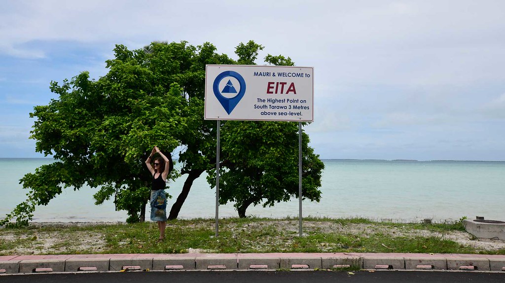
We also drove up to the highest point in Kiribati at a whopping 3 meters above sea level. Apparently when explorers first discovered Kiribati one of the hardest words to translate was “mountain,” as the concept of elevated land was completely foreign to the people here.
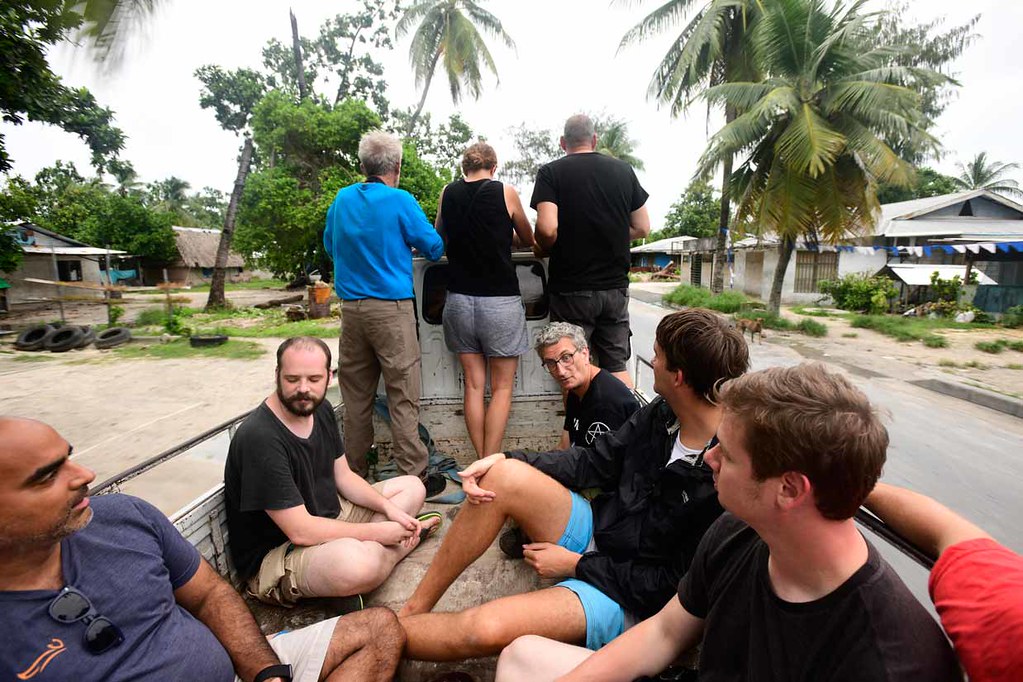
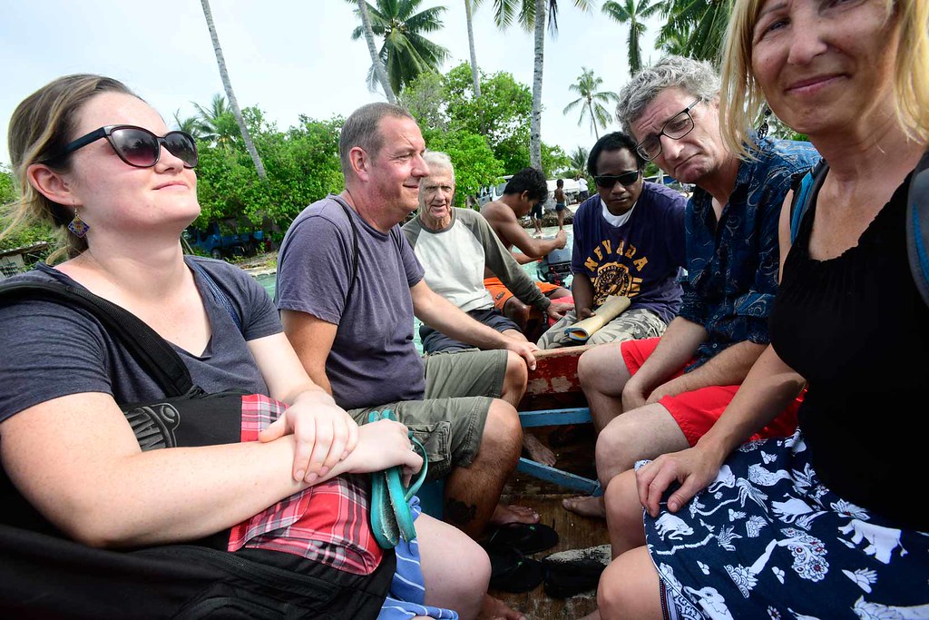
After another 30 minutes drive to the northern edge of North Tarawa, we hopped off our bus, walked across a small bridge, and hopped on top of a pickup truck for a 5 minute drive to reach this little slice of isolated paradise on the edge of Tabiteuea:
While one of us was able to swim to the other side towards Nabeina island, the rest of us took two trips in a motorized canoe across the channel.

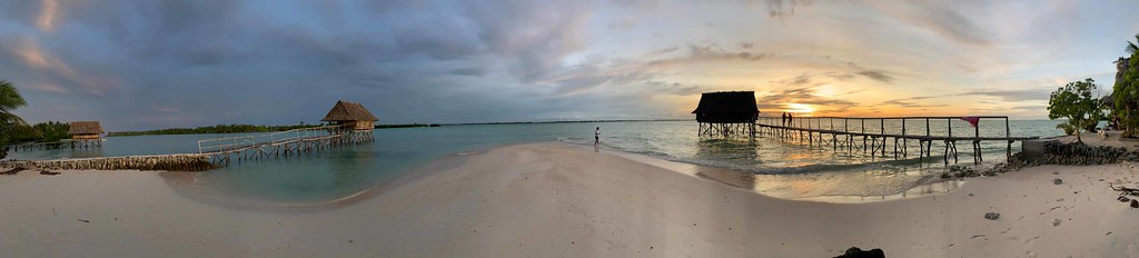
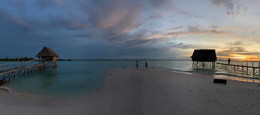
And this is what awaited us: The Tabuki Retreat
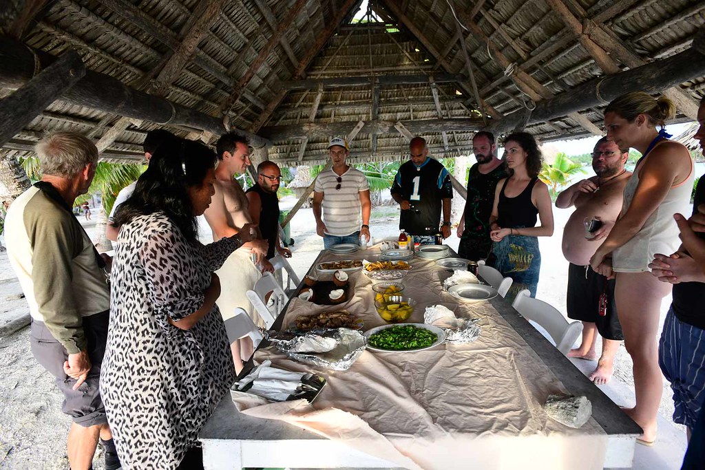
At this point hangriness began to hit hard as we hadn’t yet had lunch, so after another 2 hour wait we were finally gifted a well-earned feast consisting of fresh fish, sashimi, chicken, pumpkin, coconut, and breadfruit crisps. It was well worth the journey.
While some of us went in for a dip, the rest of us kicked back with some palm wine (aka a sour toddy, or a Kaokioki) and/or soda, and watched our first proper sunset of the trip.
At around 7pm we backtracked back to Mary’s Motel, finally returning to our lodgings at 9pm. Tomorrow we head for Honiara, The Solomon Islands!
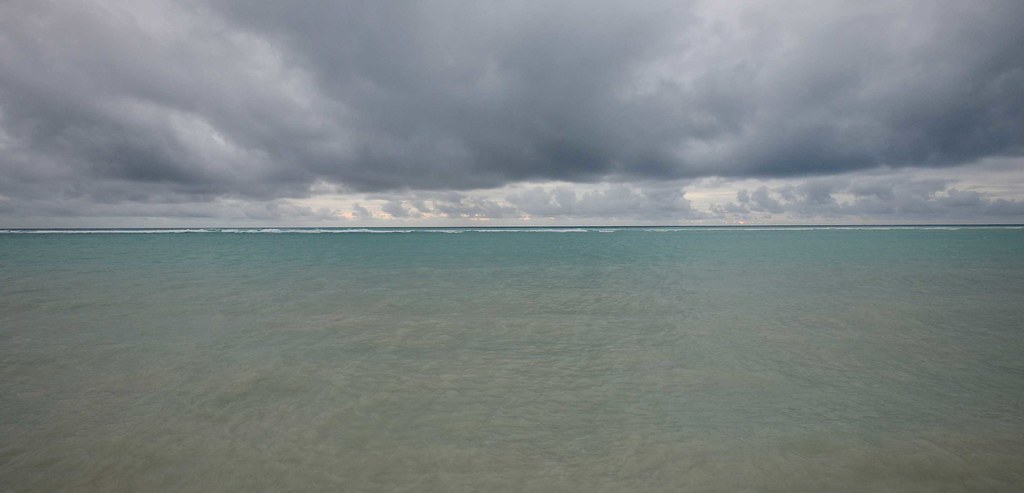
- At time of posting in Tarawa, Kiribati, it was 31 °C - Humidity: 75% | Wind Speed: n/a | Cloud Cover: rainy

