
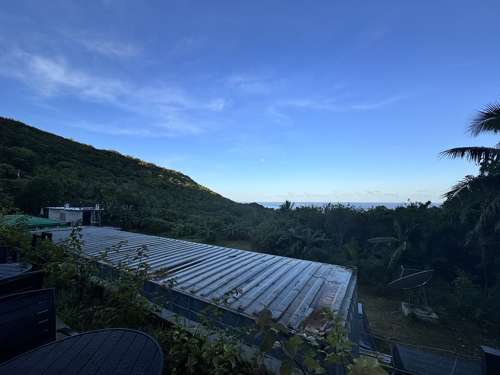
Good morning from Saipan:
After a full day exploring Saipan, the next morning felt like it was moving pretty straightforward: I had gotten 9 full hours of sleep, was promptly picked up by our taxi driver and guide Sumon at 7:45am, and even got upgraded to business class for my return flight to Guam while checking in at the airport.
Then, while relaxing in Saipan airport’s only Priority Pass lounge, I got a text and call from Sumon who said he found my Bose headphones still in his car. We were boarding in 20 minutes and he was about 15 minutes away by car, so I didn’t want to panic; this morning had already been going too smoothly.

So within 20 minutes I went through a passport check at Gate 6 (there’s nothing to go “through” but rather “check in at” with Saipan to Guam), left my bags behind at the gate 3 with Stephanie, ran out of security, picked up my headphones from Sumon and his friend as they drove back to departures, ran through security again, ran back to the gate 3, retrieved my bags, and boarded the flight just in time before takeoff.

Whew! Thank you Sumon!
After only 45 minutes in the air and sneaking enough time to write a blogpost and have a cup of joe, we landed early at 10am, once again passing through customs easily thanks to a QR code we obtained online beforehand.

Guam, an organized, unincorporated territory of the United States, sits in the southern part of the chain of Mariana Islands in the Micronesia.

Predominantly and natively Guam is inhabited by the CHamarou people, similar to those who live in Saipan (but preferring to spell it Chamarro due to an inherited generational distrust between both groups of people after Japanese occupation).
Although it looks like an island (I mean, it IS an island), Guam functions more like that of a US Navy Battleship or Aircraft Carrier floating in the Pacific Ocean: Call it U.S.S. Guam and you won’t be far off in imagining what it’s like; just like how an aircraft carrier functions like a floating city, Guam is a floating city-island that functions primarily and geopolitically as the “tip of the spear” for the U.S. military in the Pacific Ocean.

With over $4 billion dollars invested in it by the U.S. military, the construction of the Terminal High Altitude Area Defense (THAAD) into the island (THAAD is the only weapons system capable of intercepting targets both inside and outside out atmosphere), the U.S. military currently owning over 1/3 (and at one point over 2/3 of the island), and the rhetoric intensifying surrounding China’s own interests in the Pacific, Guam has been more relevant these days and perhaps at the expense of its native inhabitants.
And just as how the NY Times article writes it, like on an aircraft carrier or battleship it feels as if the U.S. military presence here on Guam carry themselves as the battleship’s staff, while the indigenous CHamarou people are treated like the mess attendants; Guam feels like a borderline if not outright colony of the modern day in the same way you can argue how Saipan, Puerto Rico, USVI, and to a more indirect sense, the independent countries still beholden to U.S. interests such as The Marshall Islands, Palau, and the Federated States of Micronesia. Furthermore, if China, North Korea, Russia, or any other belligerent nation wanted to strike against the United States in the Pacific, it would always always start with Guam.
It feels like everyone wants a piece of it.
The problem is now both CHamorou and the U.S. military have been entrenched and embedded with each other for too long to have any kind of clean separation. With so much American military money having been invested in it, Guam is both too important to abandon and yet too small to rally for statehood or declare independence; both CHamorou and the U.S. military have become symbiotic/parasitic/mutually dependent/inseparable. Guam is what is protecting us on the West.

We debated all of this during our day in Guam. And thanks to Lyla’s childhood here, she was able to connect me with her childhood friend and neighbor Sean Rodriguez, who picked us up from Arrivals and took us on a tour of his ancestral home.

Passing through the capital of Hagåtña, Sean first stopped at a random bush close to the hospital where we walked through on a 2 minute hike.

Remains of an abandoned property was at the end, with a balcony extending out over a dramatic drop to the ocean below, affording visitors wide views of the coastline. This area is also deeply rooted in the history of the indigenous CHamoru people and known as Oka Point.

We then drove back to Hagåtña and put our names down for lunch at Meskla Chamoru Fusion Bistro. While waiting, we quickly got morning coffee/matcha at the local Chatime embedded within the Ross Dress for Less mall while speaking to Lyla over FaceTime.

Then lunch…wow…so much food and so good food.

After lunch we drove to Plaza de España, originally the home of the Governor’s Palace during Spain’s occupation of Guam before the Americans. It still holds the look of its Spanish origins.


Dulce Nombre de Maria Cathedral-Basilica is a massive cathedral facing the plaza and now houses a high school where Sean and Lyla used to attend and had first met.
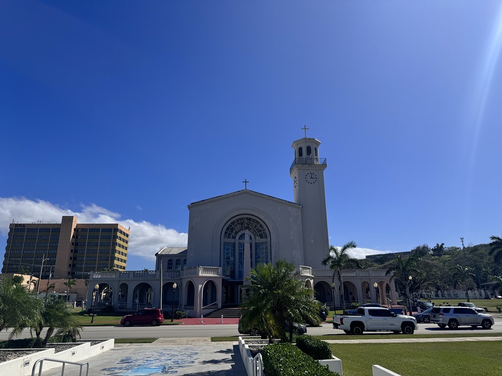

The Santa Marian Kamalen statue at the altar and under the cross is that of the Virgin Mary, and said to have been miraculously found on the seabed floor by a fisherman on the south coast of Guam with human hair still growing from it.

Needing the bathroom but seeing that none was available in the cathedral, we went across the street to the Guam Congress Building which is open to the public as a government taxpayer funded property, hence free bathrooms! Thanks America.

After freshening up we drove south and up to the US Navy World War II Memorial Park, which overlooks the bay where the Americans retook Guam from the Japanese.


Plenty of ‘murica patriotism here, with reliefs and the names of all those who were injured or had died in retaking Guam (including both the names of U.S. military and local CHamorous).


There’s a sign here that indicates the sites of all the battles that took place in the Pacific theater of World War 2.

Driving back down to sea level, we regrouped at a local church and boys’ school where Corey, Sean’s friend and a doctorate student in CHamorou language, joined us for the rest of our road trip around the island.

Our next stop: Mount Lamlam, the “tallest mountain on Earth.”
The majority of Mount Lamlam stretches continuously from its peak all the way down underwater to the bottom of the Mariana Trench, the lowest known point in the entire ocean at over 36,000 feet deep. Therefore, Mt. Lamlam is technically the world’s tallest mountain at almost 38,000 ft tall …if it weren’t for this pesky thing known as rising sea levels (Everest is only 29,000 ft from bottom to top!).


The views from here:

We then drove by random leftovers from the Japanese military when they had occupied Guam, including large cannons and guns, as well as CHamorou structures comprised of stone pillars with a cup-shaped stone on top called “lattes.”

…and a statue of the Virgin Mary carrying baby Jesus like a football about to score a touchdown.

We then passed by Sella Bay Overlook…

…reaching Fort Nuestra Senora de la Soledad aka Our Lady of Solitude Fort, which was built by the Spanish to protect their ships and cargo coming into the bay of Guam.


The views from the fort:


And on the bay below where we got some fresh coconuts, is where Magellan is said to have first landed.

There’s even a memorial marking the spot where Magellan had first set foot on Guam.

Then we reached the southernmost point of Guam by the Merizo Bell Tower, and the location of the oldest building on the island now inhabited by a priest of the local church in the town of Merizo.


This little humble spot faces their Cocos islet that is home to a resort via a ferry crossing (temporarily closed).

And with that and as the sun began to set, we drove back up around the island, passing a statue that CHamorous say resembles that of a bear.

We then finished off with a wonderful and filling ramen dinner at local staple and favorite, Fuji’s/FujiIchiban.

Afterwards with time to kill before our onward flight to Yap of Micronesia, we headed to Sean’s house with Corey and enjoyed drinks and Potu rice ball desserts while under the stars and facing Lyla’s childhood home.

Thank you Lyla for introducing us to Sean and Corey, and in turn Sean and Corey for showing us Guam hospitality and taking us around your island!
- At time of posting in Guam, it was 28 °C - Humidity: 74% | Wind Speed: 32km/hr | Cloud Cover: tropical

